New design of the Information Point on Telecommunications
The Information Point on Telecommunications has gained a new design and a number of functionalities, including: a new information portal, a map portal, a mechanism for collecting and processing spatial data, and a single sign-on point associated with the Trusted Profil.
The objectives of the Information Point on Telecommunications:
- providing information necessary when planning telecommunications investments,
- promoting cooperation among operators,
- efficient and rational use of the existing telecom engineering and passive infrastructure,
- achieving social, ecological and economic benefits as a result of reducing the scope of separate investments,
- facilitating cooperation between entrepreneurs and local government units,
- facilitating cooperation between entrepreneurs from various industries: telecommunications, energy, water supply, rail and road
New functionalities of the system
PIT enables telecommunications undertakings to access information kept by President of UKE on:
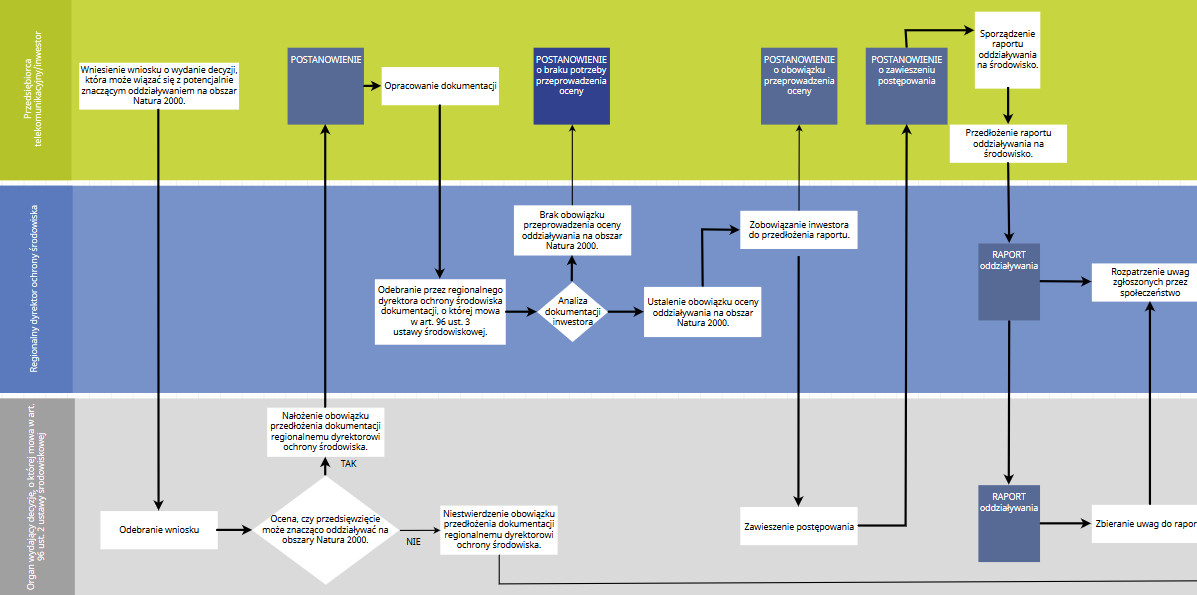
1. The formal and legal aspects of telecommunications investments
The portal includes a set of procedures aimed at facilitating the telecommunications undertakings and other interested entities to undertake investment activities by studying the descriptions and formalities resulting from the applicable provisions of law.
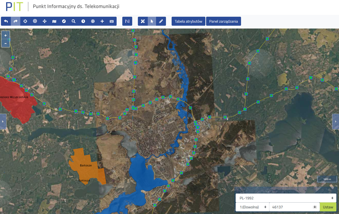
2. The current status of the infrastructure and its location
As part of PIT, the Spatial Information System was created, which presents the spatial data on infrastructure collected in the system. There have been six system layers built.
In accordance with the principle of interoperability, the PIT system also uses spatial data from other publicly available services, including:
- National Register of Boundaries - boundaries of local government units, boundaries of forest districts and address points necessary to create the tool for data geocoding.
- Gov.pl - orthophotomap, a database of general geographic objects and a database of topographic objects, the UKE KGESUT layer and digital terrain model.
- TERYT - National Official Register of the Territorial Division of the Country covers the systems (TERC, SIMC, ULIC)
- National Register of Geographical Names – data about the names of geographic features located within the Polish Republic
- Information System for Railway Lines (SILK) – map of railway lines administered by PKP PLK
- Forest Data Bank. State Forests – information on forest areas
- General Directorate for Environmental Protection - information on forms of environmental protection (national parks, reserves, landscape parks, Natura 2000 [habitats areas and bird areas])
- National integration of Land Registry, Utilities Network and Local Spatial Development Plans - data from districts (on cadastral parcels and land utilities network) and municipalities (on local spatial development plans)
- LPIS (Land Parcel Information System) Agency for Restructuring and Modernisation of Agriculture – reference data on parcels
The PIT system enables the connection of any map network service compliant with the OGC standard, including - WMS, WFS, WMTS.
3. Conditions for access to infrastructure
The PIT system collects and shares addresses of websites informing on access to real estates, these data are supplied by property managers. PIT presents the selected data from K-GESUT.
In addition, PIT enables the exchange of information by network operators, including local government units, about their networks or service ducts. This information is shared with other telecommunications undertakings interested in investments in a given area.
4. Rates for the right of way occupation
The rates for the right of way occupation are provided by road administrators through a dedicated form.

Benefits for telecommunications undertakings
Quicker access to information about:
- the existing technical infrastructure,
- plans related to infrastructure,
- service ducts,
- rates for the right of way occupation.
Quicker and easier access to data in PIT will optimize the decision-making process regarding the launch of the investment.
The system development, its promotion and presentations for external users are planned in the next phase of the project.
| Subject: | Office of Electronic Communications |
| Author: | Justyna Nakrajnik |
| Publisher: | Justyna Nakrajnik |
| Publication date: | 15.05.19 15:09 |
| Update date: | 30.07.20 11:13 |